3.1.2 The 3D Synthetic Vision
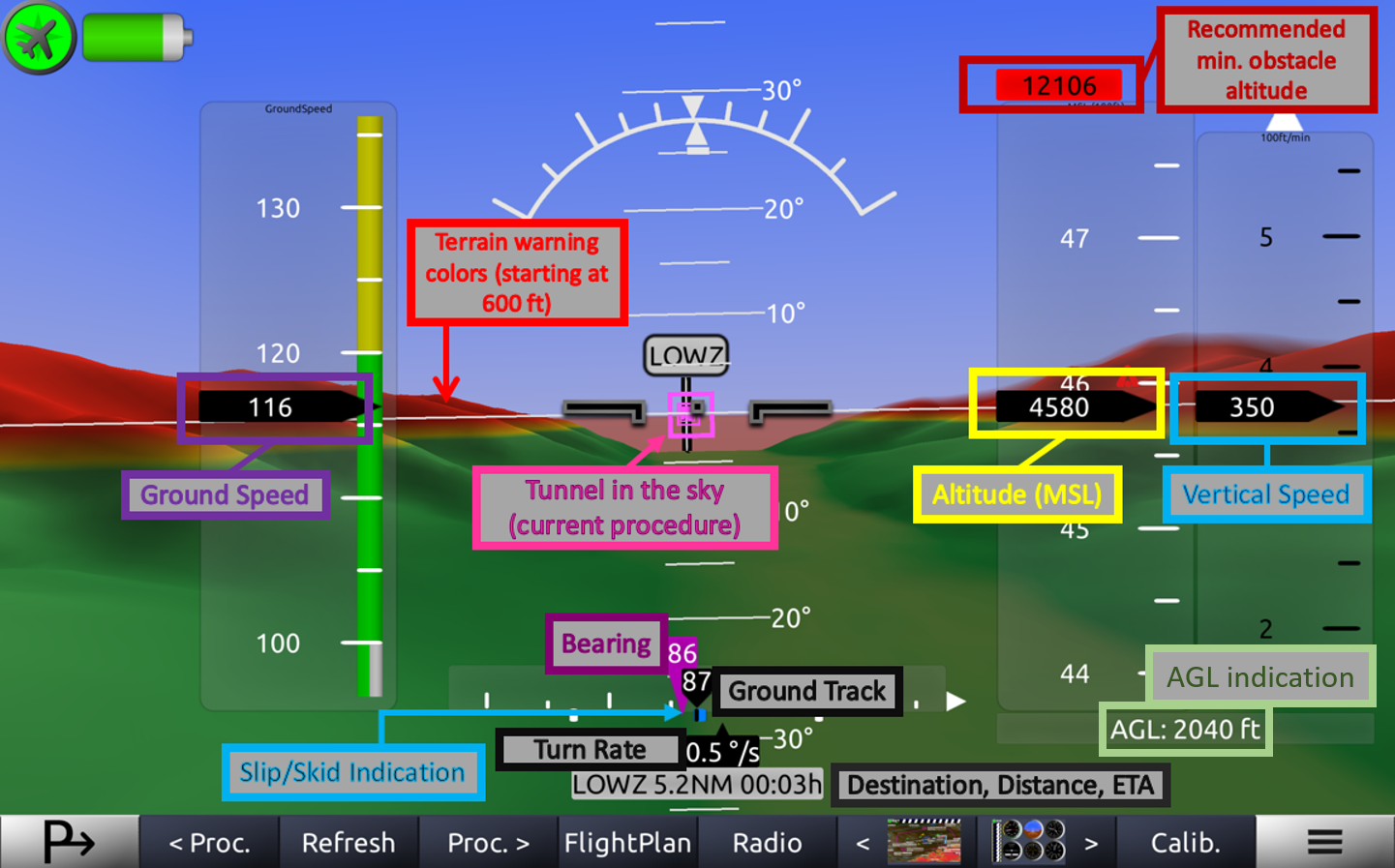
The 3D Synthetic Vision provides an indication of the aircraft's attitude as well as the area close to the aircraft such as terrain, nearby Chart Elements, Runways,... and the current Procedure.
The current Procedure is shown as a tunnel in the sky. Flying through that tunnel leads to the destination (in a way depending in the selected procedure (Direct, Approach, Holding,...).

Since Horizon 2.5 there's also an AGL (Altitude Above Ground Level) indication below the AMSL (Altitude Above Mean Sea Level) indication.
You need to install "Terrain" data packages to get terrain visualizations and AGL indications. For navigation and obstacle dependent indications regular "Data" packages need to be installed.
 |
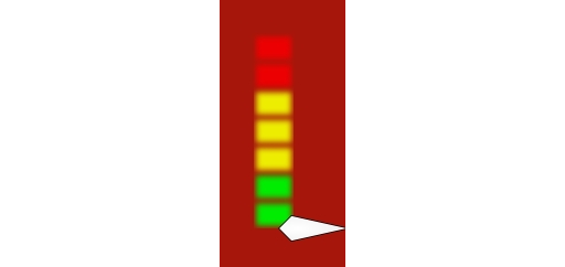
In case you're connected with a device supporting Angle of Attack: An indication will be displayed in the lower left corner of the synthetic vision. The indications are from the green area where the angle of attack is fine over the yellow one until the red one which indicates a critical angle of attack that could lead to a possible stall. |
The default altitude indication in 'Horizon' is GNSS/GPS based and thus very precise and exact if your GPS receiver is working properly. However, provided that you have a air pressure sensor connected, you can switch between GPS based and QNH (air pressure based) altitude. Switching to QNH altitude there are two possible ways to set up the settings regarding the air pressure. Either you access it through the Menu and 'QNH/Altimeter' or you click on QNH/Altimeter button when tapping the synthetic vision.