3.2.6 Weather
There are two general ways to obtain (inflight) weather information:
(1) via internet (usually mobile data or wifi hotspot)
(2) via an external SensorBox (usually ADS-B (USA only) or satellite)
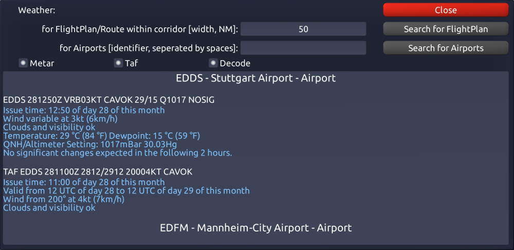
To obtain weather informations via internet click on 'Menu -> Weather via Internet'. There you have two different options for obtaining the weather information. If you have set up a flight plan you can get all Metars and TAFs for all airports in the corridor of your flight plan (the extent/width of this corridor can be set in this screen). Therefore, you would not only receive the weather information of the airports that are an actual part of the flight plan, but also from airports that are in the proximity of the flight plan.
The second option to obtain Metars and TAFs is to type in a specific airport identifier for which you will then receive the weather information. The Metars and TAFs will then be displayed in this screen. Selecting the 'Decode' function, the Metars and TAFs will be decoded into a readable format.
Please note that when flying outside of the US or generally not being equipped with an ADS-B receiver it makes sense to obtain the weather information before takeoff.
Please also note that Horizon can only obtain Metars and TAFs from airports provided that those airports actually publish this information.
In case you are connecting to a SensorBox which provides weather information, the weather information inside Horizon is automatically updated as soon as it is received during the entire flight.
 |
Next to the airports for which you obtained Metars you will see pictograms in the moving map that intuitively show the current weather (e.g. winds, cloud coverage, and ceiling). Also, on the moving map when selecting an airport and clicking the info button to open the screen containing detailed information about the selected airport you will also find the Metars and TAFs of that airport there. |